Thursday, July 11, 2013
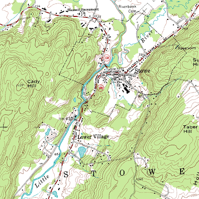
Topographic Map
A topographic map represents relief, usually using contour lines to do so. They use large-scale detail to show an accurate graphic representation of human and natural features. They represent 3-dimensional aspect of the ground on a two-dimensional surface, such as a piece of paper. Contours are used to portray land surfaces with the same elevation on the surface and they show the specific shape and elevation of the terrain. This map is a topographic map using contour lines to show the vertical component to the terrain on top of showing the horizontal component. This shows the elevation and also some cities and roads.
Subscribe to:
Post Comments (Atom)

No comments:
Post a Comment